Piła 21-08-2024
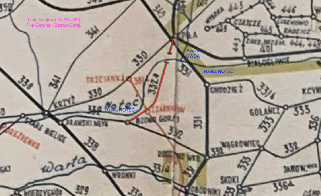
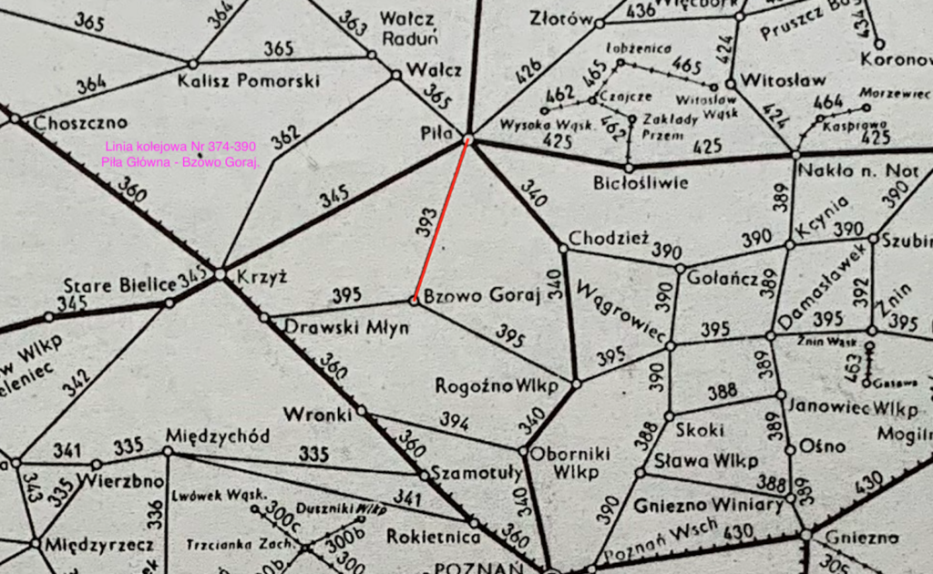
Railway line No. 374-390 Piła Główna – Bzowo Goraj.
Railway line No. 374-390 Piła Główna – Bzowo Goraj is currently a line with a length of only 14.555 km, from the Piła side (Mirosław Ujski – Piła Główna) and on the Bozowo Goraj – Czarnków section, 6.840 km. The route is of local importance, single-track, not electrified. The line runs from the Piła Główna station towards the south. The line is used for freight traffic and has a permissible speed of 40 km/h.


The line was launched in sections; In 1897, the Bzowo Goraj – Czarnków section was launched. In 1912, the Czarnków-Jabłonowo Wlkp. section was launched. In 1913, the Jabłonowo Wlkp. – Piła Główna section was launched. The main function of the line was to service industrial plants. The Motylewo and Sosnówka passenger stops on LK No. 374 were built in 1913, during the construction of tracks between Jabłonowo and Piła, and served passenger traffic until 1989, when passenger transport on the line was suspended.
They had one single-edge platform each. There was also a waiting room building in Motylewo, but it was demolished. The total length of the LK Piła – Bzowo Goraj was 43.080 km. From the very beginning, the line had a gauge of 1435 mm. The line reached the Bzowo Góraj station, which was a junction station. From this station you can go east to the Rogoźno Wielkopolskie station or west to the Drawski Młyn station.
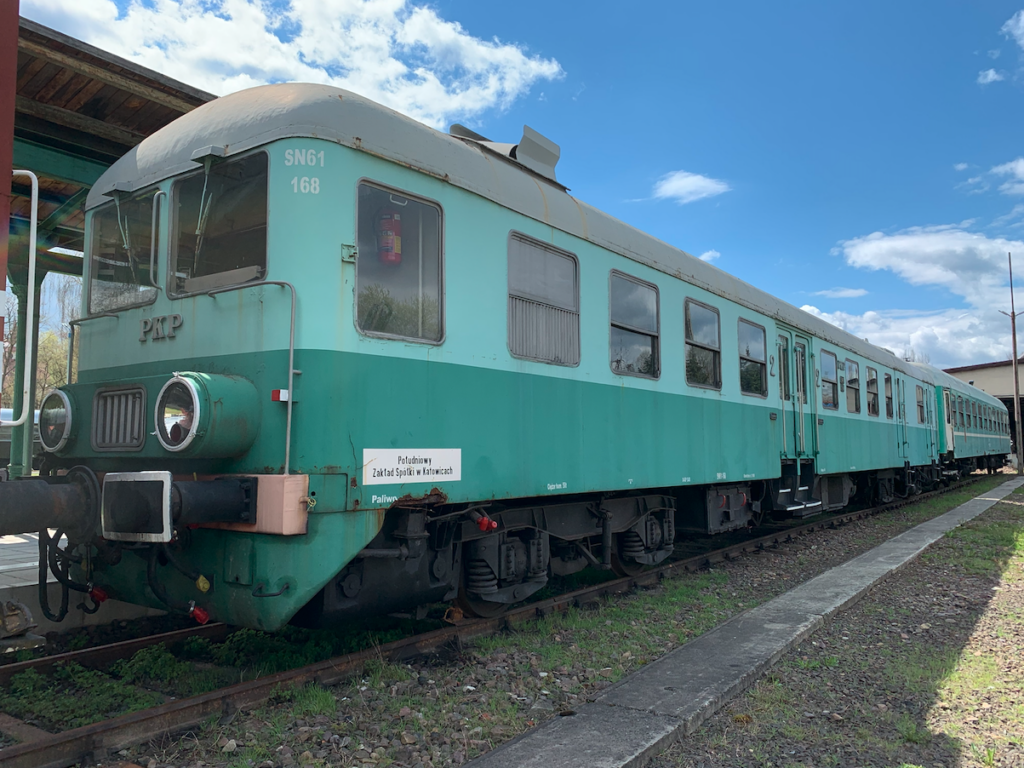
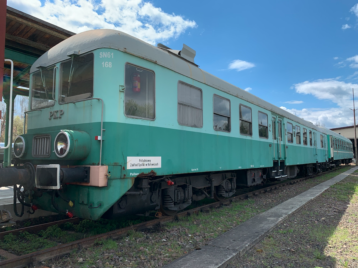
The line crosses the Noteć River. During World War II, the bridge was destroyed. In 1966, the bridge was rebuilt and the entire LK Nr. 374/390 was passable. Trains with steam locomotives ran on the line, and the train had 2-3 “Ryflak” wagons. Motor wagons of the SN61 type also ran. Currently (2024) special trains sometimes run on the route. Currently, freight transport is carried out on the Piła – Mirosław Ujski section and on the Bzowo Goraj – Czarnków section.
The course of the Railway Line No. 374/390 Bzowo Goraj – Piła Główna.
Bzowo Goraj 0.00 km, elevation 75 m. Bzowo Goraj branch 1.12 km, elevation 78 m. The line runs through the forest near Goraj Castle. The line crosses DW No. 181 on the mountain. Czarnków 6.84 km, elevation 47 m. The line bypasses the town of Czarnków from the west and crosses DW No. 182 and 178. Due to the construction of the DW No. 178 road junction, this section of the line and the next one were liquidated. Osuch was a passenger stop 10.67 km, elevation 51 m. The line ran in an arc to the east through the forest. The line crossed DW No. 182. Sarbia was a station 17.52 km, elevation 103. At the station, the tracks were completely dismantled. The line crossed DW No. 183. There are agricultural areas here. A curve towards the north. Kruszewo Wielkopolskie was a station at 21.09 km, elevation 102 m. Tracks completely dismantled. Jabłonowo Wielkopolskie was a station at 24.50 km, elevation 96 m. Buildings remain after the station. Further on, the line crossed DW No. 182. Mirosław Ujski 29.17 km, elevation 82 m. Here the active section of the line begins again. From the line there is a siding to the Pre-stressed Concrete Sleeper Factory. Ujście Południowe passenger stop 31.93 km, elevation 55 m. Ujście glassworks 32.14 km, elevation 55 m. Polish-German border on the Noteć River (1922-1939) 32.33 km. There is a truss bridge over the Noteć River. Ujście Noteckie 33.23 km, elevation 52 m. Port Handlowy Ujście 33.78 km, elevation 52 m. Ługi Ujskie 34.54 km, elevation 52 m. Before the station there is a railway-road intersection with DK No. 11. Motylewo 37.81 km, elevation 54 m. Staszyce 40.13 km, elevation 57 m. Siding to the Piła concrete plant Staszyce 42.02 km, elevation 59 m. Piła Główna 43.08 km, elevation 60 m.
Written by Karol Placha Hetman

Leave a Reply
You must be logged in to post a comment.