Poznań 2024-10-23
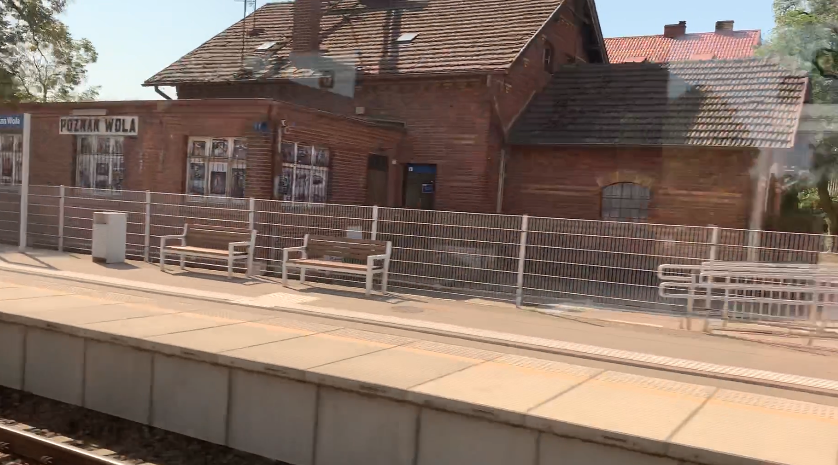
Poznań Wola Railway Station.
Geographic coordinates: 52.434N 16.849E Elevation 87 m (285.43 ft). Address ulica Sytkowska 34, 60-413 Poznań. The station was built on the railway line No. 351 Poznań Główny – Szczecin Główny, at 6.531 km. Currently, the station is located within the administrative boundaries of Poznań.
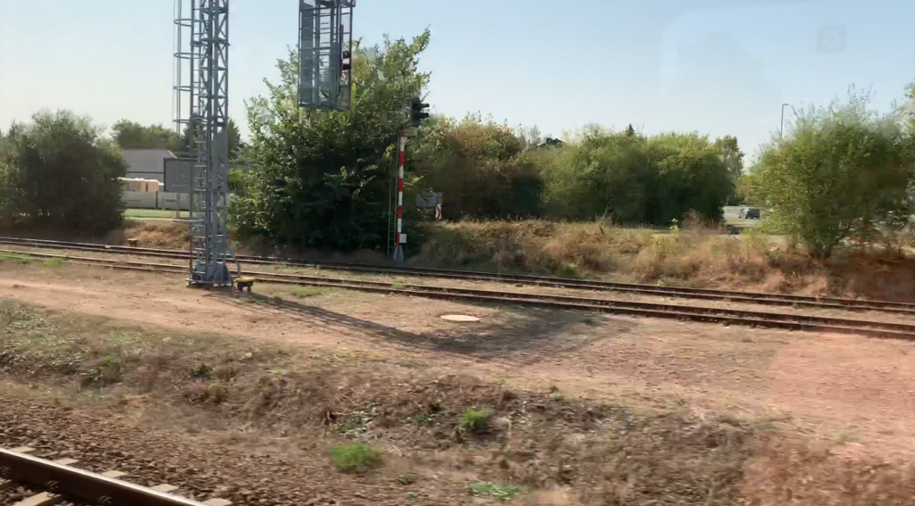
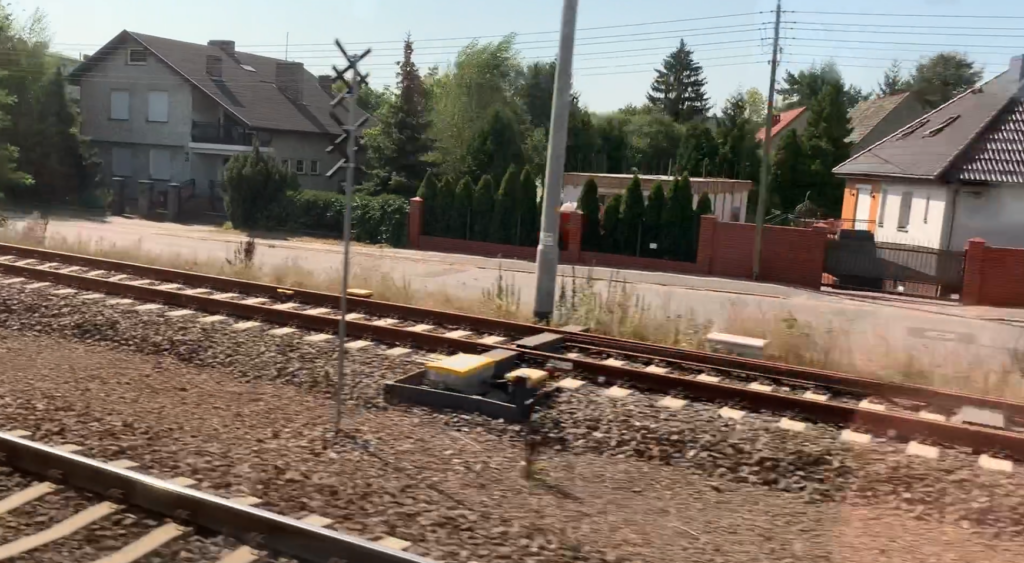
Railway line No. 351 Poznań Główny – Szczecin Główny, is a mostly double-track line, of national importance, electrified with 3 kV DC. The line runs from the south-east to the north-west. Length of the line 213,500 km. Maximum speed 160 km/h.
Initially, the station was called Elsenmühle (Else mill), from the mill on the Bogdanka River. The owner of the mill was Elsy von Petersdorff. Sometimes the station was called Felsenmühle (Rock Mill). The name was used in the period 1905-1919. The mill in the Bogdanka River valley has been preserved in ruins, about 700 m from the station in the north-west direction, at Lutycka Street (DK No. 92). Formerly, Lutycka Street was called Tatrzańska (1919-1939). This was a period when streets had mountain names: Beskidzka, Bieszczady, Wierchowa, Halna, Karpacka, Łomnicka, Karkonoska. The name of the Wola district appeared only after the Second World War, before that the area was called Sytkowo, just like the name of the street at the railway station; Sytkowska.
In the period 1919-1939, the station was called Ławica. During the German occupation it was called Boelckehorst (Boelckego Horsta) in the period 1939-1941, then Posen-Elsenmühle (1941-1944). After the Second World War, the name was changed to Poznań Ławica (1945-1949), and then Poznań Wola (since 1949).
The station was established in 1905, many years later than LK Szczecin – Poznań. The station was built mainly for military purposes, because the Prussians did not allow development of this outskirts of Poznań. On Ławica there were already barracks, automotive repair plants and a large training ground, which was later transformed into an airport.
Military plans.
Let us go back for a moment to the period of the Congress of Vienna, which, although it ensured peace in Europe for 99 years, did not satisfy many conquered nations. What is more, it made the renewed outbreak of conflicts between theoretical allies more real. Already in December 1815, Royal Prussia began to secretly rearm. Almost all of the larger cities of the former Polish-Lithuanian Commonwealth in Prussia became garrison cities, with a large number of soldiers stationed there. At the same time, Prussia became a police state, where all areas of life were controlled by the chancellor (theoretically on behalf of the king). Poznań, which became a fortress, also suffered such a military fate. Plans for the construction of fortifications were developed relatively quickly, but due to lack of funds, the construction of fortifications did not begin until 1828. The general plan assumed the construction of a polygonal fortress stretched along the strict city center. Even the Warta River was included in the defense system.
A polygonal fortress is a type of defensive belt arranged in a broken line. The ring of fortresses around the city of Poznań was built later. In August 1828, construction began on a fort on Winiarskie Hill, the later Citadel. The outbreak of the November Uprising meant that the unfinished fortress was provisionally adapted for defense. The unfinished polygonal fortress was occupied by the first Prussian infantry units in 1834. In 1839, construction of the Citadel was completed. In 1840, the second stage of construction of the polygonal fortress began. Almost all of the planned fortifications of the polygonal fortress were completed: Fort Roon, Fort Prittwitz-Gaffron, Bastion Colomb, the Railway Caponier and three locks on the Warta River. In 1864, construction of the fortress was officially completed. At that time, all fortifications of the Poznań Fortress received new names derived from the surnames of outstanding Prussian commanders.
Later changes in the polygonal fortress resulted primarily from the introduction of new types of weapons and ammunition and the development of railways. The armament included new guns (150 mm and 210 mm), for which new bases had to be made. Ammunition depots were expanded. Railway lines were added. The appearance of horse trams also forced changes in the layout of the polygonal fortress. Gates in the walls were widened and new crossings were made. Wooden bridges were replaced with riveted iron ones. The development of the city meant that, for example, a new railway station (currently Poznań Główny) was built outside the polygonal fortress.
Subsequent war experiences around the world showed that the polygonal fortress was obsolete. New guns with rifled barrels easily destroyed walls. Additionally, railway lines that cut across the city significantly weakened the defense system. Ultimately, a general model of a fortress city was developed, which assumed adding a ring of artillery forts to the existing fortifications, spaced every 3–6 km and 6–12 km away from the existing polygonal fortresses. However, it turned out that even for the Prussians this was a huge expense. Therefore, fortresses in the whole of Germany were divided into three categories. The first fortresses were to be modernized. The second ones were to be modernized so that they would not be captured by surprise, and the third group was to be decided later, leaving them in their current form. Poznań Fortress was in the first category.
The construction of the fort fortress, i.e. the external belt of fortifications, began in 1876. The main forts were arranged in a ring with a diameter of 9.5 km at regular intervals of 6–8 km, creating a defense line about 30 km long, 2.0–4.5 km away from the polygonal fortress. The last of the forts was put into use in 1886. It quickly turned out that the new explosives used in projectiles were able to quickly deal with the new forts. These new materials appeared over the period 1883-1888. In Prussia, this caused a crisis of the existing defense doctrine and conflicts at the top of the command staff. Analysis of the situation led to the conclusion that the artillery should be significantly dispersed and individual batteries should be made independent, including ammunition depots in their organization. The forts and independent batteries were equipped with a much larger number of machine guns. The Poznań Fortress was still important, so it was subjected to another modification, building small intermediate forts. Their construction was completed in 1896. Ultimately, 18 forts were built. Additionally, numerous shelters for the infantry and weapons depots were built. Also, 4 new training grounds and 2 shooting ranges were put into use for the infantry and artillery. The increased number of forts resulted in the construction of new barracks complexes on Bukowska and Grunwaldzka streets.
After the ring of forts was built, the polygonal fortress became militarily unnecessary. However, maintaining it hindered the development of Poznań. Already in 1891, the then mayor of Poznań proposed the liquidation of elements of the polygonal fortress, which occupied a total of 144 hectares. The army demanded a large compensation (18 million marks) for the liquidation of the facilities. The city could not afford it. Ultimately, the central authorities in Berlin paid the army compensation (12 million marks). The demolition of the polygonal fortress was completed in 1912, leaving a few elements, such as the Citadel. Already in 1900, another plan for the modernization of the Poznań Fortress was prepared. As part of it, more bunkers, shelters, ammunition warehouses and observation posts were built. The work was completed in 1907. The next changes were initiated in 1910, with the development of another, outer ring of fortifications, including in the following towns: Puszczykowo, Szreniawa, Plewińska, Ławica (Lawitz), Suchy Las, Radojewo and others. Due to the lack of funds, the construction was limited to shelters, earthen fortifications and barricades.
As can be seen, the Prussians-Germans never spared any attention or funds for armaments, constantly analysing scenarios of future armed conflicts. And their greatest enemy was and is the Polish Nation.
Ławica Airport.
The outer ring of Poznań fortifications did not develop in accordance with military plans. The barracks in Ławica (Lawitz) became an exception. This happened because new types of weapons appeared in the army: the airship and the airplane. The first successes in the field of aviation did not pass unnoticed in Prussia. In particular, Louis Blériot’s flight over the English Channel, in a machine heavier than air, caused excitement. It was on July 25, 1909. In many countries, citizens began to fund airplanes and airports. Poznań was no different. The initiator of the construction of an airport near Poznań was the local daily Posener Tageblatt. The intention was to build an airport and fund an airplane with the name Poznań from the Poznań community. As proven above, no such initiative could be implemented without the consent of the army. Most of the funds came from the army budget. The army decided to reinforce the V Army Corps stationed in the city with an aviation unit. The entire airport in Ławica was built according to military plans. The Prussians called the airport Die Fliegerstation Posen-Lawitz, and Flieger Ersatz Abteilung Nr 4 (Replacement Air Force Unit Nr 4) was stationed there. A large brick barracks building with headquarters was built in the complex (in the period 1911-1913). The second brick building was a warehouse with a water tower incorporated into its walls (in the period 1912-1913). At the same time, this tower was an observation post. A dozen or so wooden barracks were built on the eastern side, for various purposes. A railway siding was built to the airport from the north-west, ending with several railway ramps. The take-off area was given a rectangular shape with a small, natural slope towards the south. It had dimensions of about 1,300 m x 700 m. Two metal hangars were built along the northern end of the take-off area, which still exist today. Each of these hangars was designed for 10-12 aircraft. To the east of the take-off field, an air station was located, i.e. workshops, carpentry shops, wood drying rooms and warehouses. It was in these buildings that the Wielkopolska Wytwórnia Lotów “Samolot” later operated. The entire airport occupied an area of 300 hectares. The official opening of Ławica Airport took place on August 26, 1913, and was performed by Emperor Wilhelm II. The attraction was an aircraft called Poznań. A military parade also took place. Thousands of Poznań residents took part in the ceremony. At that time, there were about 15,000 Prussian soldiers in Wielkopolska. During the Great World War, they set off to various fronts, but in 1918 there were still 2,000 soldiers in Poznań and the surrounding area. In August 1914, the Great World War broke out. A school for pilots and mechanics was set up in Ławica. A large percentage of students were Poles, who after Poland regained independence became the core of the Wielkopolska Aviation. Since during the war, Ławica Airport was far from all war fronts, one of the aircraft depots was organized here. Aircraft were repaired here.
Ławica / Wola railway station.
Against this background, we can understand the purpose of building the Ławica railway station, which was also called Poznań Ławica (Posen Lawitz). Since the station was located in the Wola district, the name was changed to Poznań Wola. The neighboring districts are Smochowice and Golęcin.
The station was built in 1905. From the station towards the south, two sidings were led, which in the following years grew into a whole network. The furthest tracks were led to Bukowska Street, to the old civilian airport. The sidings served, among others; a military aviation unit (3. Pułku Lotniczego Street), Wojskowe Zakłady Motoryzacyjne, Fort VII, Stary Port Lotniczy, Wielkopolskie Zakłady Lotnicze “Samolot”. Currently, on the PKP side, from the side of LK Nr 351, the sidings are maintained in good condition. On the other hand, on private and industrial lands, the tracks are unused, often divided by renovated streets, where the tracks were removed or new fences were erected, blocking any potential rail traffic. No sidings were built to the north because there were areas unsuitable for investment; the marshes of the Bogdanka River.
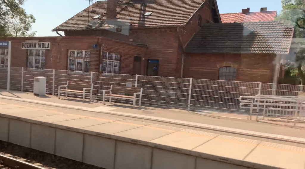
A station the size of a large single-family house was built at the station. A railway signal box is adjacent to the building, which currently no longer serves its purpose. The building was built of red brick, has a basement and a developed attic. It is covered with a gable roof with a large swallowtail. The roofing is made of dark roof tiles. The windows are narrow, double-leafed, but high, ending with typical arches. The building was not plastered.
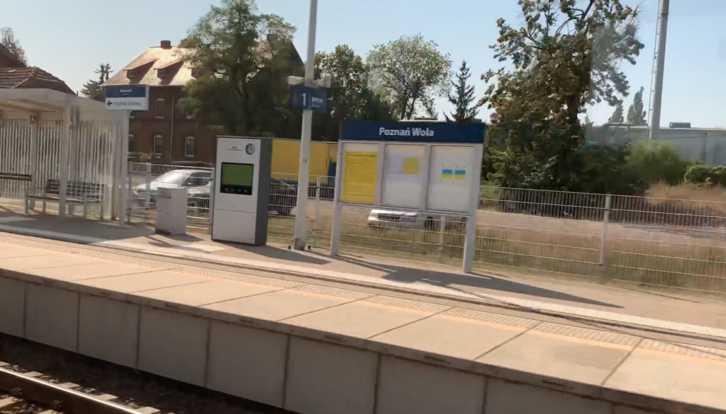
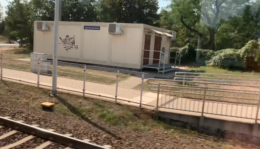
The last renovation of the station was carried out in 2018-2019, during the renovation of LK No. 351. Currently, the station is practically a passenger stop, where trains of Koleje Wielkopolskie; Poznań Metropolitan Railway – PKM stop. There are two single-edge platforms at the station, for both directions of traffic. There are no ticket offices, but there are ticket machines for PKM trains. There are new high platforms and all difficulties for passengers in wheelchairs and families with children in wheelchairs have been eliminated. Several ramps with protective barriers have been installed. Both platforms are 200 m long. On each platform there are two bus shelters, additional benches, display cases with railway information, electronic information boards, an audio system, waste bins. The platforms are fenced. The surface is made of gray perfabricated slabs, measuring 1 m x 2 m, with a yellow warning line and buttons. The rest is covered with concrete pavement slabs measuring 0.5 m x 0.5 m. Paths for the blind have been installed. The platforms are lit.
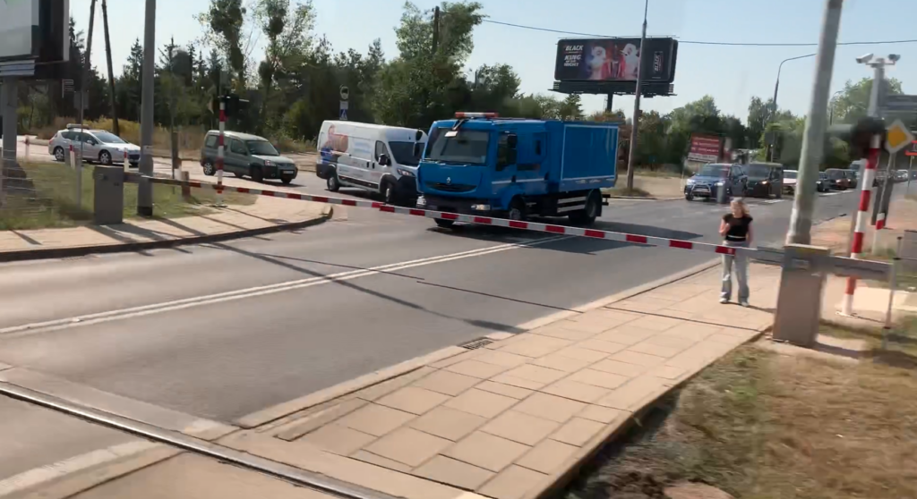
Traffic at the Wola station is controlled from LCS Poznań (ESA 44-PL computer equipment), and at the Wola station there is only a new automatic control building. The rail-road crossing along Lutycka Street, which is right next to the Poznań Wola station, is operated in the same way. Initially, there were two signal boxes at the station: PWd (closed in the station building), PWd1 (demolished in 2019). Light semaphores were installed at the time of the renovation of LK No. 351; in 2018. There was a frontal-side unloading ramp at the station. There was also a railway scale of 26,000 kg (until 1973), and then 80,000 kg (1973-1989).
In 2017, the station served up to 100 passengers per day, and in 2022, up to 150 people per day.
Written by Karol Placha Hetman
Leave a Reply
You must be logged in to post a comment.