Krzyż Wielkopolski. 2024-10-15
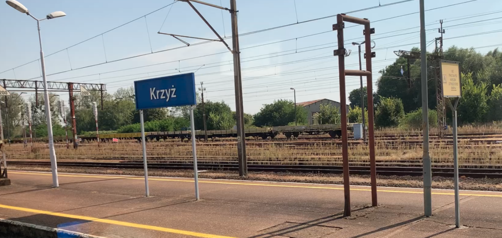
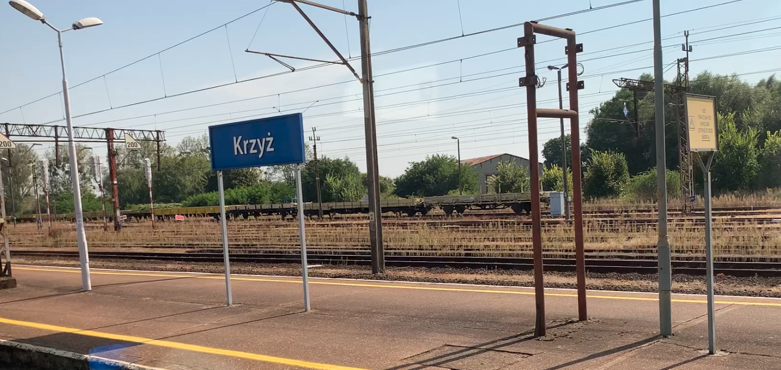
Krzyż Wielkopolski Railway Station.
Geographic coordinates: 52.875N 16.011E. Elevation 32.00 m (104.99 ft). Address Tadeusza Rejtana Street at the exit of Wojska Polskiego Street. Krzyż Wielkopolski.
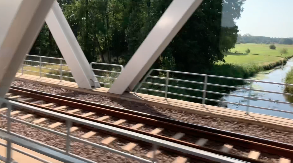
Krzyż Wielkopolski Commune.
Krzyż Wielkopolski Commune is located in the Wielkopolska Province near the border with the Lubuskie Province and is part of the Czarnkowsko-Trzcianecki District. The address of the commune office is Wojska Polskiego Street 14, 64-761 Krzyż Wielkopolski. The area of the commune is 174.56 km2. The population of the commune was 8,820 inhabitants (2004), and later 8,764 inhabitants (2016). In the period 1975-1998, the Krzyż Commune belonged to the Piła Province.
Let us remember that until 1772, these areas belonged to the Republic of Poland and was in the Poznań Province. In the period 1772-1887, there was the Kingdom of Prussia, Czarnków district. In the period 1887-1919, there was the German Empire, Wieluń district. In the period 1920-1945, there was the Weimar Republic transformed into the Third Reich. Since 1945, again the Republic of Poland.
Until 1991, the town of Krzyż Wielkopolski was called Krzyż. In 1991, the name was changed because the name Krzyż had nothing to do with faith and the Cross of Jesus Christ. The name was taken from the layout of important intersecting railway lines, which were built in the 19th century, when the Republic of Poland was under partition.
The town of Krzyż Wielkopolski and its surroundings lie on the Noteć River and its floodplains. There are 13 lakes in the Krzyż Wielkopolski commune: Borowe, Jelenia Krew, Jezioro Perliste, Jezioro Polne, Kłodno, Łokacz, Mały Raczek, Piasecznik Wielki, Pniewo, Przesieki Drugie, Raczek, Radzyń Średni. From the south, there is the vast Notecka Forest, while from the north there is the wooded Dobiegniewskie Lakeland.
The Noteć Forest is a huge forest area located between the Warta River in the south and the Noteć River in the north, in the Gorzów Basin. Since 2004, the Noteć Forest has been called the Noteć Forest Promotional Complex. The forest has an area of 1,372.29 km2. It is about 100 km long, with an average width of about 20 km. The forest consists of 1 landscape park and 16 nature reserves. The landscape of the forest is diversified by large dune banks, which create a labyrinth of valleys and hills. The highest elevation on Wielka Sowa, reaches a height of 42 m, with an elevation of 93 m. The center of the forest is very poor in water and was not a good place to establish human settlements. However, near both large rivers, the areas have an excess of water in the form of channel lakes and swamps. Only the banks of the Noteć are treeless and slightly more suitable for cultivation. Lakes, fields and meadows are the so-called exceptions in the sea of the belt. The forest stand is mainly pine, with an admixture of birches, oaks and other trees and shrubs.
The Dobiegniew Lakeland is a picturesque region located in north-western Poland, in the Lubuskie Voivodeship, near the town of Dobiegniew. This area is part of the larger South Pomeranian Lakeland. This region is famous for its numerous lakes, forests and hilly landscape, which creates a unique natural scenery, including mangrove forests. The Dobiegniew Lakeland is known for its many clean lakes. The largest and most famous of them are: Lake Wielgie, Lake Radęcin and Lake Osiek. This region abounds in mixed forests. In the surrounding forests you can find numerous species of wild animals, including roe deer, deer, wild boars, as well as a rich variety of birds, which attracts birdwatching enthusiasts.
The village of Krzyż.
A river port was established in the settlement of Krzyż on the Noteć River. The moderate development of the region dates back to the 18th century, when the Sapieha family became the owners of the Wieleń estate. They began to establish the first settlements. In 1701, Prince Jan Kazimierz Sapieha, the owner of nearby Wieleń, founded the settlement of Oleandry Sapieżyńskie. The Olęders who settled there began the process of drying the marshy area. The name of the settlement was too difficult to pronounce for some of the settlers, so the name Łokacz was soon used. It is worth mentioning that the word Łokacz means idler. In 1848, there were only 17 farms and 350 inhabitants in the village.
A civilizational leap occurred in the 19th century, when the Germans built the Szczecin-Poznań railway line in 1848, and the Berlin-Bydgoszcz line in 1851. The creation of a railway line from Berlin to Königsberg was for the Prussian King Frederick William IV a matter of the greatest love for the Muscovites. He expressed his feelings as early as 1842. Around 1844, it was decided that the new railway line should run along the route Berlin – Kostrzyn – Piła – Bydgoszcz – Tczew – Malbork – Elbląg – Frombork – Königsberg. In the summer of 1847, work began on the bridges over the Vistula and Nogat in Tczew and Malbork.
In June 1848, in today’s Krzyż Wielkopolski, then on the territory of the Sapieha estate, in the village of Łokacz, a railway station was opened, temporarily called Dragemünde “Drawoujście”. In July 1848, stations were opened in Piła, and in September 1948, in Nakło. When buying the land, 200 thalers were paid for a morgen of meadow and 175 thalers for a morgen of field. Due to the fact that the Krzyż station is located in areas flooded annually by the Noteć, it was necessary to bring in sand and gravel in order to raise the terrain and strengthen the ground. The sand was supplied by a dune located in the village of Łokacz Wielki, and the gravel came from Przeborów on the Drawa River.
There are discrepancies in written sources regarding the opening dates of individual railway stations. This results from the dates given for the commencement of construction or their opening, without specifying which date is meant. Since no private investors were found for the railway to the relatively sparsely populated areas of East Prussia, the Ostbahn was built as a state railway. The draft of the relevant decree was submitted to parliament in mid-1847. The procedure lasted over two years. After administrative changes, the decree was adopted as a law on 7 December 1849. An important role in the construction of the Ostbahn was played by the revolutionary riots in Berlin in 1848, as well as the prevailing unemployment and progressive impoverishment of the population. In the spring of 1848, state offices came up with the idea of removing the rebellious and unemployed Berliners from the city and using them to build the Ostbahn.
Both lines (Szczecin-Poznań and Berlin-Königsberg) crossed near the settlement on the Noteć River. In June 1848, new construction workers arrived at Dragebruch near Kreuz (Cross). By September 1848, the number of workers had already increased to 1,300 people. They worked 12-14 hours a day. The workers were quartered with local farmers. The workers were supervised by engineers delegated from Berlin. The work progressed relatively quickly.
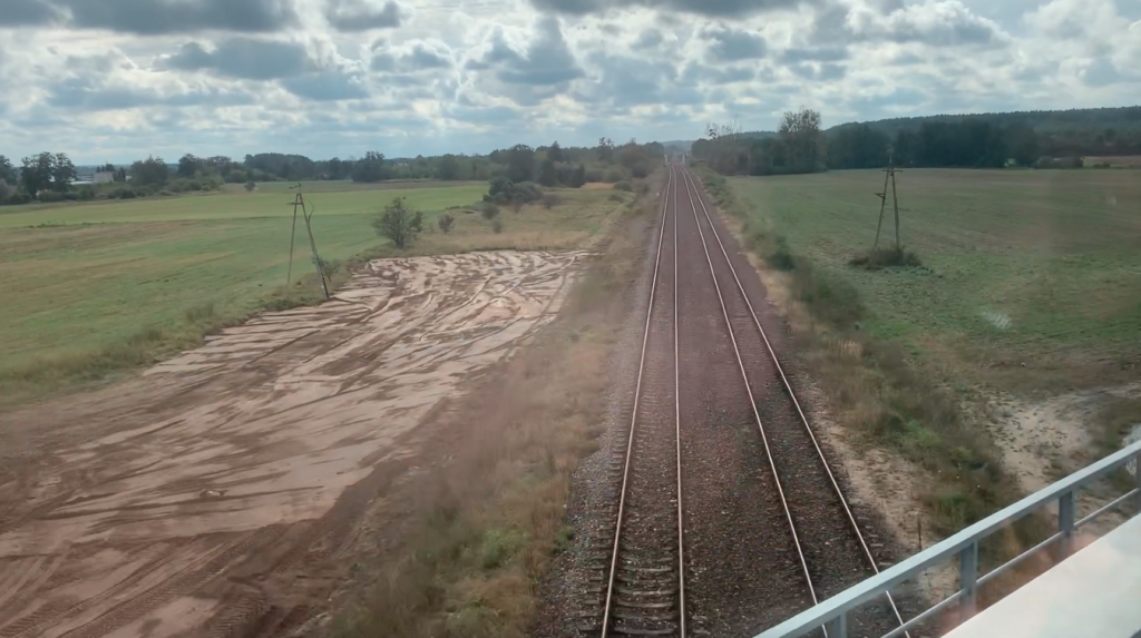
Most Ostbahn tracks were planned as double-track. Only a few were single-track. European tracks were used, with a gauge of 1435 mm. The distance of the track axes between one track and the other was 4.00 m. The sleepers were made of pine wood from a length of 2.50 m. The total track width was 10.40 – 11.00 m. The single-track track had a minimum width of 4.50 m. The sleepers were laid on a gravel bed, and in places where the gravel was washed out, on a crushed stone bed. Drainage ditches were made along the track, on both sides. This was the case when the line was laid in flat terrain. It was more difficult to build a railway line in undulating terrain, where embankments and cuttings had to be made. At that time, much larger masses of earth and rock material had to be transported. Initially, the rails were made of iron, and later they were replaced with steel rails. This is where the name came from; the Iron Railway. The biggest problems were caused by the construction of bridges over rivers. Bridgeheads were always built with a double-track line in mind, although initially a bridge span was laid for a single track. In general, in Pomerania, the construction of railway lines was relatively easy and allowed for the construction of very long straight sections. Few structures were built on embankments and cuttings. Telephone lines were built along the tracks.
The Krzyż–Piła iron road (62 km) was the first section of the Ostbahn route. The route was then led to Bydgoszcz. (Piła–Bydgoszcz 88 km). The first train to Bydgoszcz arrived on July 27, 1851. The route from Kreuz (Krzyż) to Bromberg (Bydgoszcz) was inaugurated by King Frederick William IV, who traveled this route in a special train and was joyfully welcomed at all stations. On April 1, 1849, the Eastern Line (Ostbahn) office was opened in Bydgoszcz.
Krzyż station was a good place for servicing locomotives and wagons. Therefore, a locomotive shed, a water tower, fuel entanglements, storage yards and ramps were built. Warehouses, a small station building and three apartment blocks were built. The apartment blocks still exist and are inhabited (2024). The blocks are located on Tadeusza Rejtana Street. All of them are two-storey with a developed attic. The largest central block was made of Prussian brickwork and has a basement. Dark brown brick was commonly used in the buildings.
The color of the brick is influenced by clay, its chemical composition, which has different colors in different regions of Poland. That is why we get a variety of bricks – Lico Pomorskie, Lico Wielkopolskie, Lico Kaszubskie, Lico Mazurskie, Lico Podkarpackie, Lico Śląskie. The red color is the iron compounds contained in the clay. A more yellow brick means more calcium compounds contained in the clay. Brick is not only red, it can be in shades of orange, brown, pink, sand. The method and time of firing the bricks are very important. First of all, the firing temperature has an impact. A higher temperature causes a darker color of the brick. Dark red bricks are also fired at a higher temperature, but for a shorter time. Bricks are lighter when fired for a long time at a low temperature. The color of the brick is also affected by exposure to atmospheric factors and its aging processes. Bricks can become darker when exposed to rain, wind and sunlight.
The railway became the driving force of the town of Krzyż. Many residents became railway workers. New residents arrived from poorer areas. Craft workshops were established to service railway workers and their families; bakeries, butchers, hairdressers, tailors, shoemakers, restaurants, taverns, confectioneries, shops. Year by year, rail traffic increased; the transport of goods and passengers. In 1882, an evangelical community was established and an evangelical church was built. It is currently a Catholic church under the invocation of St. Anthony. The town slaughterhouse was opened in 1901. A new post office building was built in 1904. In 1912, the expansion of the neglected river port began, which also contributed to the further development of the town. In general, the town had and still has low-rise buildings. The highest are the church towers.
Many researchers believe that in Germanic times the station celebrated its greatest triumphs and shone with brilliance. If it were so in 1939, Krzyż would have had 15,000 inhabitants. In reality, in 1900, the city had 4,500 inhabitants and in 1939, 4,922 Germans. In 1900, on the Gorzów Wielkopolski – Krzyż section, 10 pairs of passenger and freight trains ran, and currently (2024) on the Gorzów Wielkopolski – Krzyż route, 15 pairs of passenger trains run daily.
In 1899, a new railway line Krzyż – Człopa – Wałcz was built. The line was single-track. The total length of LK No. 412 was 60.791 km. The first section of the LK Krzyż – Człopa was opened on 12 December 1899, the next section Człopa – Wałcz on 1 December 1904. The line was little used. It gradually fell into degradation. In 1980, a passenger train ride on the entire section took 2 hours 40 minutes, which gave an average speed of 25 km/h. Further degradation of the LK led to the closure of the Wałcz – Człopa section in August 1988. In 1991, passenger traffic was suspended on the Krzyż – Człopa section. In 2000, freight traffic on the railway line was completely suspended. In 2002, the LK was removed from the list of railway lines. By 2016, the line had been completely dismantled. On many sections of the old track, dirt roads were built; field and forest roads. In Człopa, there is still a station building, and bus stop shelters, among others, in Huta Szklana and Kuźnica Żelichowska.
Two more railway lines were built in the area of the Krzyż junction. LK Drawski Młyn – Bzowo Goraj and LK Stare Bielice – Skwierzyna. The lines were built in the period 1910-1915. They were single-track lines and are currently (2024) liquidated.
As a result of the Great World War and the Greater Poland Uprising, Poland was reborn. In the period 1918-1919, during the fighting, the insurgents reached the Noteć River and fought to occupy the Krzyż railway junction and the surrounding towns. However, under the Treaty of Versailles, the Polish-German border was established on the Noteć River. (June 28, 1919). Krzyż station became a Germanic border station. The Polish station was Drawski Młyn with connections to Poznań and to the towns of Bzowo Goraj, Czarnków, and Rogóżno Wielkopolskie.
According to the 1925 census, the town of Krzyż already had 4,774 inhabitants. On May 17, 1939, the town had 4,922 Germans. Next to the railway station there were rolling stock repair plants, a factory producing baby food (a grain product), a starch factory and a river port. Krzyż received its city rights in 1936, still in Germanic times. The town was granted a coat of arms referring to the past. The right part of the Sapieha family coat of arms was adopted; a white (silver) cross on a red background.
During World War II, in the winter of 1940, 12 pairs of passenger trains ran on the Krzyż – Piła route, all of which were long-distance, and most of them ended in Królewiec. There were also trips to Toruń, Korsze and Ełk, as well as to the German-Soviet border in Ejkuty and further to Klaipėda, Kaunas and Riga.
The turn of the years 1944-1945 was very difficult for Krzyż and the surrounding area. Large transports of Germanic troops and people evacuated from the east passed through the city and the railway junction. The last rail transport of evacuees left on 26 January 1945. The city was occupied by the Muscovites on 27 January 1945. It was the 5th Shock Army commanded by Colonel Jesipienka. The scale of destruction of the city’s buildings was estimated at 50%.
Krzyż Wielkopolski within the borders of Poland.
The Polish population flowed into the city of Krzyż. The first group of pioneers, including Polish railway workers, arrived from Wągrowiec on 17–19 February 1945. Krzyż became a Polish city, which was confirmed by the decisions of the Potsdam conference in August 1945. In April 1945, railway workers began to open locomotive workshops, a water tower was launched, fuel for steam locomotives was collected, and damaged tracks were repaired. The abandoned, surviving houses were occupied by repatriates from the Eastern Borderlands annexed by the Soviets. Interestingly, the last train with Germanic people went west in October 1946. Even at that time, there were attacks by Germanic gangs on the railway lines. Windows were broken in moving wagons and wood was laid on the tracks just behind the railway arches. From March 1945, there was one pair of passenger trains on the Krzyż – Poznań route and one pair Krzyż – Inowrocław.
In the period 1945-1990, the importance of the Krzyż railway junction was moderate for several reasons. The junction was no longer part of the German-Soviet love, the Ostbahn. The Krzyż junction mainly served as a transit for goods from the center of Poland to the ports in Szczecin and Świnoujście. A large percentage of trains were military transports; Soviet and Polish Army. There were a lot of Polish military units and Soviet occupiers in this region of Poland. There were also transit trains from the CCCP to the GDR. The PKP company was cautious about investing in this area. Electrification was not planned. Electrification began only in 1977, but only on LK Nr 351 Poznań – Szczecin.
Until the 1960s, the city was a makeshift place. Residents feared the return of Germans as a result of the Soviet-Germanic agreements. Ironically, the existence of the GDR slowly sanctioned the belonging of these lands to Poland again. It was in the 1960s that the construction of single-family houses built by Poles began. These houses, although not very pretty, were very practical, equipped with electrical, water and sewage installations and with an inseparable garden. The first new schools, kindergartens, health centers and pharmacies were opened. The first multi-family blocks were built on the streets of Zachodnia, Tadeusza Kościuszki, Józefa Wybicki and Kalinowa. The residents of these blocks, deprived of their own gardens, established Family Allotment Gardens in the eastern part of the city: Kolejarz and Bratek. In the new 21st century, developers took up the construction of new apartments, who currently offer modern apartments, for example in the four-storey block at Adama Mickiewicza 50 Street.
Road communication: National Road No. 22 (western border – Kostrzyn nad Odrą – Grzechotki – northern border). This is a former road route of Germanic-Muscovite love, whose role decreased after the construction of the Berlin-Königsberg railway line. Voivodeship Road No. 174, 54 km long and connects Drezdenko through Krzyż Wielkopolski and the outskirts of Wieleń with Kuźnica Czarnkowska. The road runs parallel to the Noteć riverbed along its entire length.
Krzyż Wielkopolski Railway Station.
In 1848, the first railway station building was opened. It was a building on the site of the current station. It was single-storey with a developed attic. The building was covered with a gable roof, with a medium slope. Entrance porches were built on both sides of the building, by the long walls. The station stood in the inter-track area, i.e. it was and is an island station, typical of many cities in Poland; Piła, Toruń, Poznań and others. At that time, three blocks for the families of railway employees were already built, on today’s Tadeusza Rejtana Street.
A new station was built around 1890. From the side of the tracks, the station resembles a palace, although in reality it had and has a small cubic capacity. The station consists of five parts. The outer and middle parts are three-storey. They are covered with hipped roofs, covered with sheet metal. The internal parts are two-storey with a developed attic. They are covered with a gable roof. The main entrance was placed in the western gable of the building. The royal chambers were placed in the eastern wing, just like in Piła and Toruń. Roofs were installed over the platforms along the building. The building contained ticket and luggage offices, waiting rooms, a restaurant, service rooms (telegraph, telephone switchboard) and apartments. Currently (2024) the ticket offices are closed. The ticket office was closed in February 2012. The change in the building was to cover the middle part with a gable roof instead of a hipped roof.
Access to the platforms and the station was provided from around 1900 by a steel footbridge over the tracks, which led from the current Wojska Polskiego Street, on the western side of the station building. Interestingly, a station square was never built at the station. It was not needed, because the station was practically transit. The current footbridge is a completely new steel structure, which, in addition to stairs, was equipped with elevators.
Around 1910, a tunnel was built for passengers on the eastern side of the station building. Currently (2024), the tunnel requires renovation and has been closed to pedestrian traffic. The largest modernization of the track system took place around 1910, when a grade-separated intersection of the Poznań-Szczecin line and the Berlin-Königsberg Ostbahn line was created. The line from Poznań passes along the southern side of the station, then heads west, climbing the railway embankment and, in an arc to the north-west, passes over the viaduct over Portowa Street and the viaduct over the Ostbahn line. The new line connects with the old track before the bridge over the Drawa River. In the old town, a street was built, which is currently called Długa Street.
In the 1940s, the station had 5 platforms and 7 platform edges. Platform 5 was eliminated. Currently (2024) there are 4 platforms at the station, which have 6 platform edges. The platforms are not numbered one after the other. Platform 1 is single-edged on the southern side of the station and is 490 m long. There is a small 20 m long roof at the station. Platform 2 is an island and is 430 m long. There are three new bus shelters on the platform. The surface is asphalt and paved with trilinka. Platforms 1 and 2 serve trains on the Poznań – Szczecin route. Platform 3 is single-edged on the northern side of the station. The platform is 400 m long. Platform 4 is an island and is located on the city center side. The platform is 450 m long. There is a 180 m long shelter on the platform. Platforms 3 and 4 serve trains on the Piła – Gorzów Wielkopolski route. Platform 5 served trains in the direction of Wałcz.
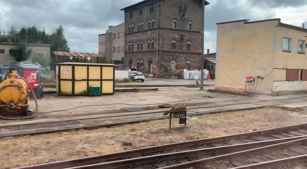
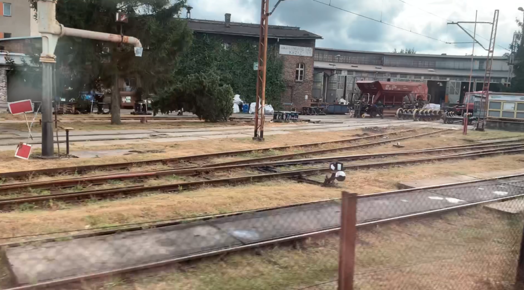
In the area between the tracks, where the station is located, there are also other railway buildings. Among others, a shed, warehouses, forwarding, Kr. Signal box. There is also a technical monument here; Steam locomotive Ol49-82. The main fan-type locomotive shed is located in the western part of the station. The locomotive shed has 17 stands and a turntable. The facility is still used for rail needs by the PolRegio company. In its history, steam, diesel and electric locomotives have been serviced here. EZT EN57 and motor wagons were inspected. There are three repair pits nearby. Next to the locomotive shed is the water tower building and the boiler house. The second water tower is located on Tadeusza Rejtana Street. Near the locomotive shed there are unused coal entanglements.
To the west of the station there is a river port, with a port basin, which is currently not used. A railway siding led to the port. Currently, part of this siding is used by the LPG Gas Transshipment Terminal. Also on the west side of the station are: Traction Substation “Krzyż Wielkopolski”. PKP Energetyka Plant. Communication Works Plant. To the east of the station are: PolRegio Repair Hall. Kr1 Signal Box. Ballast and pre-stressed concrete sleeper storage yards. Here are the main tracks of the freight station. There was also a hump at the station.
All passenger trains stop at the Krzyż Wielkopolski station; InterCity (TLK InterCity) and PolRegio. The exceptions are long-distance trains, which normally run on the Poznań – Piła – Szczecinek – Białogard route, and due to renovations, run on the Poznań – Krzyż – Stargard – Runowo Pomorskie – Białogard route, without stopping at these stations. For example, InterCity 3806 Malczewski on the Kraków Główny – Kołobrzeg route, 741 km, travel time 9 hours 16 minutes.
All main tracks at the Krzyż Wielkopolski station are electrified, and the semaphores are light. The station has Kr, Kr1, Kr2, Kr3 signal boxes. In the 1970s, the line was electrified in four stages. The individual stages of electrification were completed: On May 27, 1975, the Poznań Główny – Rokietnica section. On September 10, 1977, the Rokietnica – Krzyż section. On June 21, 1978, the Krzyż – Choszczno section. On December 15, 1978, the Choszczno – Szczecin Główny section.
Let us remember that in the period 1995-2002, there was a systematic liquidation of rail connections, lines, and even railway stations. In 2002, on the Krzyż – Gorzów Wielkopolski section, there were only 4 pairs of passenger trains. The station is a transfer station for travelers to Gorzów Wielkopolski. Currently (2024) there are 15 pairs of passenger trains on the aforementioned section. Every now and then, the issue of electrification of this section returns. In long-distance traffic, Krzyż Wielkopolski is an intermediate station on the Poznań Główny – Szczecin Główny section. The number of long-distance connections increases in the summer season, due to the location of the station on one of the direct routes to the Baltic Sea. In 2022, the station served 1,500 passengers per day.
Railway Lines at the Krzyż Wielkopolski station.
Railway line No. 203 Tczew – Piła Główna – Kostrzyn is a 342.890 km long, double-track and single-track, non-electrified line. From Tczew it runs south-west to the western border of Poland. The line runs through the Pomeranian, Wielkopolskie and Lubuskie provinces. The maximum speed of the train is 120 km/h. The line was laid out in long straight sections and if the line had a greater impact on the Polish economy, it would be possible to increase the speed to 200 km/h. The Krzyż – Bydgoszcz section was opened on July 26, 1851.
Railway line No. 351 Poznań Główny – Szczecin Główny is a line running from the south-east to the north-west. It is a 213,500 km long single and double track line, electrified with 3 kV DC current. The line is a part of the international E 59 main line, which runs from Scandinavia to the South of Europe. Apart from Nadodrzanka, line No. 351 is the basic line connecting Szczecin with central Poland. The line is located in three provinces; Wielkopolska, Lubuskie and Zachodniopomorskie. The section of the railway line from Dobiegniew to Wronki (Stargard-Poznań Railway) together with the station in Krzyż, temporarily called Dragemünde “Drawoujście”, was put into service on June 20, 1848.
Written by Karol Placha Hetman
Leave a Reply
You must be logged in to post a comment.