Kołobrzeg 2024-11-14
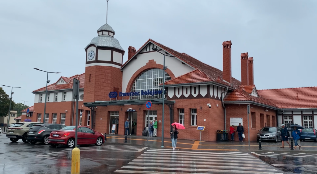
Kolobrzeg Railway Station.
Geographic coordinates: 54.182N 15.569E. Elevation 2.00 m (6.56 ft). Address: Aleja Kolejowa 3, 78-100 Kolobrzeg.
The city of Kołobrzeg.
Kołobrzeg is a seaside city in northwestern Poland, located on the Baltic Sea, in the West Pomeranian Voivodeship, in Kołobrzeg County, at the mouth of the Parsęta River. The city is a popular resort and health resort, known for its sandy beaches, picturesque port and rich tourist offer. Kołobrzeg attracts many tourists due to its health values, such as brine, peat and mild, maritime climate, which are conducive to the treatment of the respiratory tract and circulatory system.
The city of Kołobrzeg has a long history, dating back over 1000 years and played an important role in the history of the Slavic Pomeranian Lake District. Kołobrzeg is an important sea and fishing port. There are many rebuilt monuments in Kołobrzeg, including the 14th-century St. Mary’s Cathedral, a lighthouse, a town hall and numerous monuments and museums. One of the seaside buildings is the Kołobrzeg pier, which is 220 meters long and is the longest reinforced concrete pier in Poland. Another building in the city is the lighthouse built in 1946, on the site of the previous one blown up in March 1945 by the Germans. The most valuable monument in the city is the St. Mary’s Basilica, built in the Gothic style. It is a co-cathedral dedicated to the Assumption of the Blessed Virgin Mary.
The settlement of Kołobrzeg was founded in the 8th century, as indicated by excavations. City rights were granted in 1255. Then the city came under Germanic rule. On September 1, 1939, the stupid Germans started World War II and lost a lot. By the decision of the great ones of this world, the Pomeranian Lake District, together with Kołobrzeg, once again entered the borders of Poland. In the period from 4 to 18 March 1945, architects from Moscow took over the city and razed it to the ground. On 18 March 1945, the Soviets entered the city supported by a unit of the Polish People’s Army. During the war operations in March 1945, known as the Battle of Kołobrzeg, the city was destroyed by 95%. A new occupation began. Near Kołobrzeg in the town of Bagicz, in the period 1945-1993, the Soviets had a large air garrison, one of many in Poland. Today, this area is known as the Podczele Estate.
Today, Kołobrzeg is one of the most popular tourist destinations on the Polish coast, offering a variety of attractions, from cruises to numerous festivals and cultural events. The city’s population is 43,680 and the city is fourth in the Pomeranian Lake District, after Szczecin, Koszalin and Stargard, and in Poland it ranks 95th. The city’s area is 25.67 km2. The city is accessible via National Road No. 11 and Expressway No. S6.
PKP Kołobrzeg.
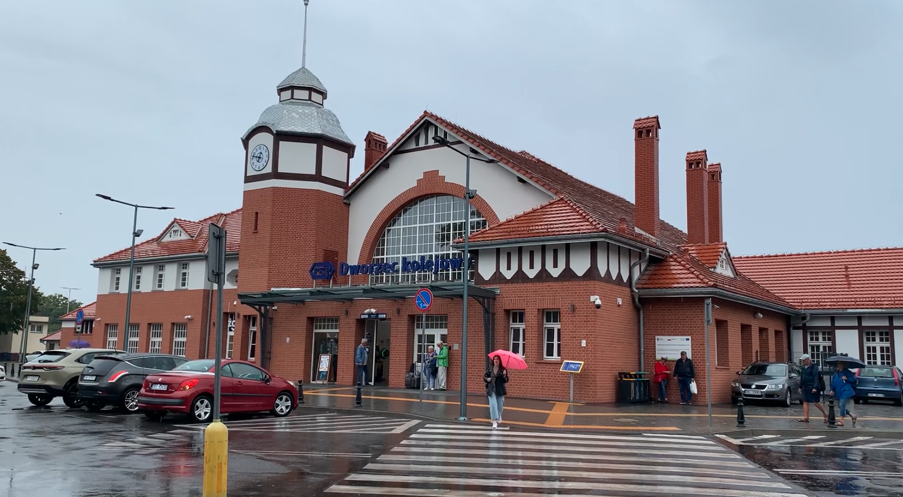
Kołobrzeg railway station is the main railway station in the city, located in its central part, located near the port, beach, and the historic city center. The station is an important communication hub, serving both regional and long-distance traffic, for which it is the final station. Trains from Kołobrzeg station run to various cities in Poland, including Warsaw, Krakow, Poznań, Gdańsk and Szczecin. The railway areas separate the health resort and port from the city and constitute a spatial barrier in the development of the urban layout.
The first train arrived in Kołobrzeg in 1859, from the Białogard side. In the period 1859-1945, the station bore the Germanic name Kolberg. In the initial period, the station was a head station and maintained traffic on the Kołobrzeg – Białogard route. On May 25, 1882, the line towards Szczecin, belonging to the Dąbie – Kołobrzeg Railway Company (Altdamm-Kolberger Eisenbahn), was put into service. At that time, Kołobrzeg station became a through station. On May 18, 1899, Kołobrzeg became a junction station when the line to Koszalin was opened.
Currently, there are three railway lines from Kołobrzeg station; all within LK No. 404 Szczecinek – Białogard – Kołobrzeg and LK No. 402 Goleniów – Kołobrzeg – Koszalin. All lines are single-track. The lines to Białogard and Koszalin are electrified. The line to Goleniów is operated by diesel traction, and previously by steam.
The station was built from the city center side. It has been modernized several times throughout its history. Its current appearance is due to the reconstruction carried out at the beginning of the 1950s, almost in the same form as in 1906. The current station building offers passengers typical amenities, such as a waiting room, service points, ticket offices and catering points. According to the PKP classification, it has the category of a tourist station.
In the period 2022-2024, the last major renovation of the station building was carried out. The historical shape of the tower, windows and entrance doors was recreated. The facade was thoroughly renovated. Facade lighting was installed. The roof was renovated. The interior layout of the rooms was improved. The waiting room was separated from the main hall with ticket offices. The waiting room is large and has a passenger information desk. The historical paintings in the hall were restored. The lighting, passenger information desk, benches and small architecture were replaced. The tourist information desk and the public transport ticket sales point were located in the eastern wing.
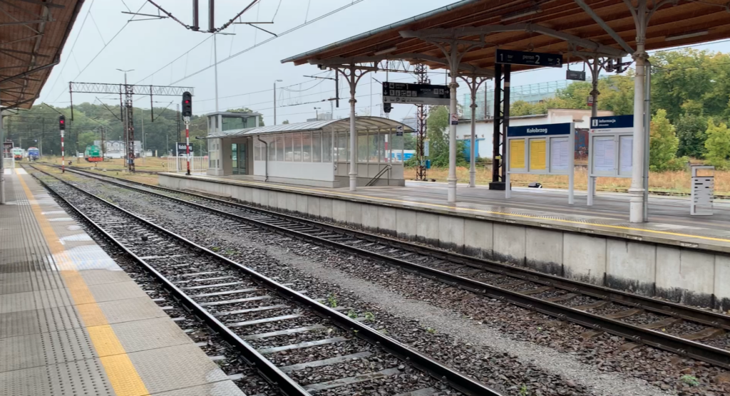
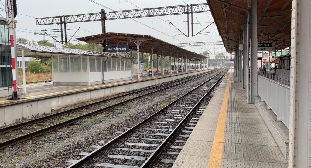
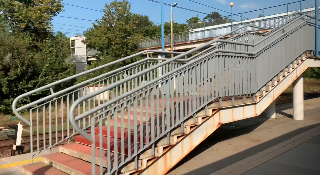
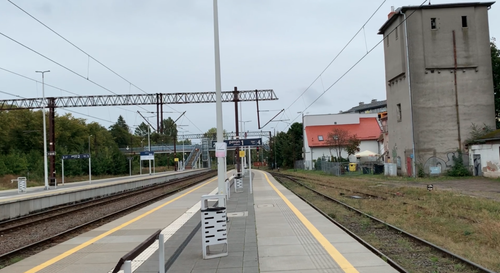
The station has two high and covered platforms. Platform 1 at the station building has two tracks; one through and the other one not through (the one on the city side). The total length of the platform is 410 m. Platform 2 is an island and has two edges. It is 425 m long. The roof is 85 m long. Access to the platforms from the west is provided by a tunnel that connects Platform 1 and Platform 2. There are lifts for the disabled and travelers with large luggage or bicycles. On the east side there is a footbridge over the tracks, which was built in the 1960s. The footbridge also connects both parts of the city. During the last renovation, the footbridge was equipped with lifts for the disabled and travelers with large luggage or bicycles. On the north side, the station is limited by a fence and Zdrojowa Street.
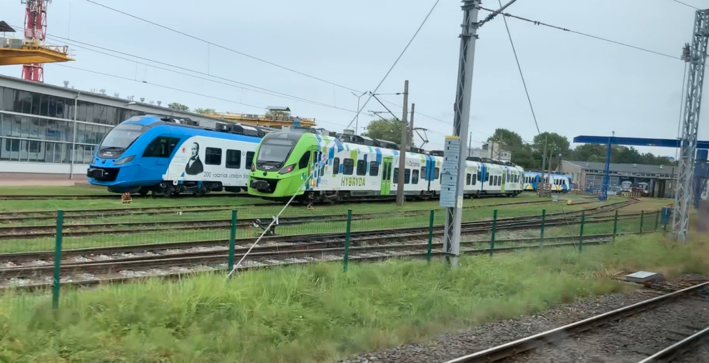
The last expansion of the Kołobrzeg station facilities began in March 2015. This was due to the need to conduct inspections and stops of the increasingly numerous EZTs. Przewozy Regionalne signed a contract with Skanska for the expansion of the parking hall and social facilities in the locomotive shed. On December 8, 2015, the new facilities were put into operation.
The main siding to the sea port runs from the Kołobrzeg station and is still in use. Part of the railway tracks run through the streets, and their layout is expanded.
Regional trains (Zachodniopomorskie), InterCity, and even InterCity EIP (Pendolino) arrive in Kołobrzeg. In 2022, the station served up to 4,000 passengers per day.
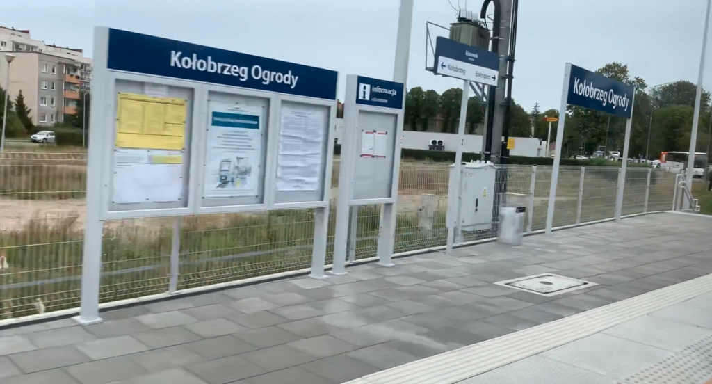
The second standard-gauge station in Kołobrzeg was Kołobrzeg Kostrzewno (Germanic Kolberg Siederland), located at the intersection of Jedności Narodowej, Solna, and Bałtycka streets, and is currently called Kołobrzeg Stadion. Currently (2024) there are three passenger stops within the city limits: Kołobrzeg Stadion (in the west of the city, LK No. 402), Kołobrzeg Amphiteatr (on LK No. 402 to Koszalin), Kołobrzeg Ogrody (on LK No. 404 to Białogard).
There was also a Kołobrzeg Wąskotorowy station. This station was the starting point for the narrow-gauge railway line that led to Karlino, Gościno and Dargocice. The station was located next to the Kołobrzeg Kostrzewo station. This station was closed around 1962.
Railway line No. 402 Koszalin – Goleniów.
Railway line No. 402 Koszalin – Goleniów is single-track, non-electrified, of national importance. The line is 142.939 km long. Initially, it runs latitudinally, and from Kołobrzeg it heads south-west. In the period 2010–2013, modernization works were carried out, which consisted of: replacing the track surface, track and drainage works, replacing the crossing surfaces, repairing and modernizing selected platforms and installing bus shelters, rebuilding railway traffic control devices, repairing engineering structures and building telecommunications. Part of the investment was the construction of tracks connecting LK No. 402 with the airport in Goleniów and the construction of a passenger stop in front of the airport terminal. Kołobrzeg station is located on 42,430 km of the line.
Railway line No. 402 Koszalin – Goleniów was built in stages. On 1 January 1882, the Płoty – Mosty section was launched. On 1 February 1882, the Gryfice – Płoty section was launched. On 25 May 1882, the Gryfice – Kołobrzeg section was launched. On May 18, 1899, the Kołobrzeg–Koszalin section was launched. In the period 1909–1929, it was changed in Goleniów. The end of LK No. 402. On October 29, 1988, the Koszalin–Kołobrzeg section was electrified. The maximum speed of the train is 120 km/h, but most of the route is 80 km/h. Kołobrzeg station is located at km 42.432 of LK No. 402.
Railway line No. 404 Szczecinek – Kołobrzeg.
Railway line No. 404 Szczecinek – Białogard – Kołobrzeg is a route located in the West Pomeranian Voivodeship. The line runs from the south-east to the north-west. LK No. 404 is 99.803 km long. The line is single-track and electrified with 3 kV DC. The maximum speed is 100 km/h. The line is of national importance. The line runs along the Parsęta River, but does not cross it. Kołobrzeg station is located at 99.416 km of LK No. 404.
Written by Karol Placha Hetman
Leave a Reply
You must be logged in to post a comment.